


MAPPING & SURVEILLANCE


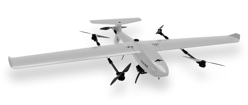
50 Minutes
8 Kilometers
300 Hectares
PPK/RTK
Maximum Endurance
Telemetry Range
Max. Mapping Coverage
Optional
Designed for complex aerial mapping challenges in rugged terrains. Its compact design ensures seamless take-offs and landings in tight spaces, delivering unmatched flexibility and accuracy for data collection.


The Future is Autonomous
Drone technology, which is now affordable and widely available, is constantly evolving and finding new applications around the world.
The applications are virtually limitless.
AGRICULTURE & FORESTRY
INFRASTRUCTURE
MINING
OIL & GAS
POWER & ENERGY
DISASTER RESPONSE
URBAN PLANNING
FILM & MEDIA
LOGISTIC
MILITARY & LAW ENFORCEMENT

RAYBE
Drone
4 x 50 min
Flight Time
24MP RGB
Sensor
5 cm/px
GSD Resolution
150 m
Flight Altitude
1000 ha
Coverage
Mount Semeru, 2021
Volcanic Eruption Emergency Response
How We Help?
Partner with us for drones that blend innovation with simplicity, offering customizable, durable solutions and unwavering support. Embrace technology that propels your success, backed by local excellence.


